Got a GPS device or an iPhone? Here are some of the best GPS software tools for 2012.
There are many GPS tool available online. The first thing to determine is what kind of software you are looking for. Do you want something that will interact with an existing GPS device or a mobile device, or a program that is only for computer use? Some of the programs are photo related and focus on geo-tagging and other such features. Each of the listed programs is unique and has specific benefits.
#1 EasyGPS: Transfer Info From PC To GPS Device
EasyGPS from TopoGrafix allows users to transfer information from their computer to their Magellan, Garmin, or Lowrance GPS. Other TopoGrafix products like PanTerra or ExpertGPS can communicate with EasyGPS as well. With EasyGPS, users can send information like waypoints and routes to their GPS. The waypoints will be listed on the left side of the screen and the GPS data on the right. The points can also be sorted and listed according to elevation, distance, or name. For users with the correct brand of GPS, EasyGPS is one of the best choices.
#2 Google Maps with GPS Tracker
When it comes to free software, Google tops many lists, so it is not surprising to find they have a product on the list of most useful GPS tools. Google Maps with GPS Tracker utilizes 3G or GPRS to upload the user’s position to a Google Maps display. Almost any GPS device can be connected to the software and setup is easy, especially if you take advantage of the instructions available online. The software can also be configured to work with Google Earth. Before downloading, be aware that not all features area available in the free version and some may require an upgrade to use.
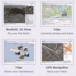
#3 MapSphere: iPhone app
Users who use the iPhone may be familiar with the ultra convenient MapSphere app. Those users will be happy to know that MapSphere is also available for regular Windows computers. The program organizes all sorts of geographical data, including raster maps, satellite images, and information from GPS devices. It makes the information manageable so that it can easily be accessed and used, and it also allows any information that was obtained online to be downloaded and saved for use while offline.
#4 Pictomio: Manage and Geotag photos
Pictomio is also a great choice, but it is a completely different sort of program. It is not technically GPS software and is in fact considered freeware for managing images. However, Pictomio is different from most image programs in that it features extensive geotagging capabilities. There is a built in PictoGEO add on which makes the program GPS compatible, a 3D trip display for including travel information, and support for GPS tracksticks and manual geotagging. It may be categorized as a picture program, but it definitely acts like GPS software.
Each of the options listed are completely different. EasyGPS allows user to transfer information from their computer to their GPS, while Google Maps works in the opposite direction and transfers information from the phone to the computer. MapSphere gives the computer GPS capabilities even when it is offline, and Pictomio does geotagging and all sorts of other photo related functions.